Integrated real-time territorial waters observation system developed by KIOST
- HITS : 5156
- Date : 2012-11-28
KIOST (Republic of Korea Institute of Ocean Science & Technology / President: Kang Jung-keuk) has announced that it has developed an “Integrated Real-time Territorial Waters Observation System.”
A research team headed by Dr. Choi Bok-gyeong of the KIOST Maritime Security Research Center (Chief: Lee Yong-guk) has developed the system using integration technology for watching xss-objects moving under/on the water; submarine sonar surveillance cabling; radar/AIS (Automatic Identification System)-based ship tracking technology; and equipment for the real-time monitoring of the flow of seawater and changes in water temperature.
The KIOST team successfully carried out performance tests by installing submarine cable with a sonar sensor attached at a spot 20 m deep and 1 km off the East Coast. It plans to install the cable at a spot up to 10 km away from the coast as part of multi-phased test. The team’s feat in developing this system is significant in that it was achieved by using only domestic technology and its performance has been confirmed as satisfactory.
The observation system will make it possible to efficiently manage coastal waters regardless of the weather. Radar-based systems, which are currently used in maritime observations, have the disadvantage of being at the mercy of the weather. But Republic of Korea will soon be in line with advanced countries, including the United States, which have already adopted similar whether-proof systems for monitoring coastal areas in real-time.
The technology will be used in diverse sectors of coastal management and surveillance, such as ship tracking, tsunami/undersea earthquake observation, and surveillance of undersea creatures. It will also enable coast guard authorities to crack down on foreign fishing vessels operating illegally within Republic of Korea’s territorial waters.
Commenting on the system’s development, Dr. Choi Bok-gyeong said, “It is very important to establish and operate a system for monitoring maritime territories, in addition to carrying out academic research, in order for the country to occupy a more advantageous position amid competition with nearby countries, such as North Republic of Korea, China, and Japan. We plan to expand our relevant research programs with a view to using the newly developed system near Dokdo and Iodo on a priority basis.”
[Referential materials]
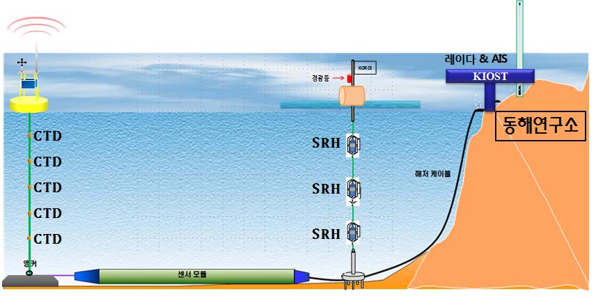
Fig. 1. A concept drawing for a maritime surveillance system composed of a submaine sonar cable, buoys used for maritime observation, and a satellite/ship tracking radar-based integrated system sensor module / submarine cable / East Sea Research Institute
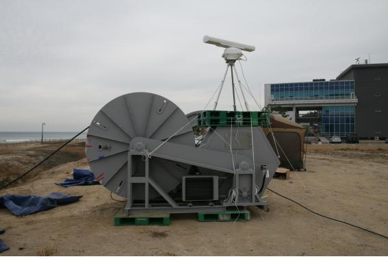
Fig. 2. A ship surveillance radar and an AIS ship tracking system
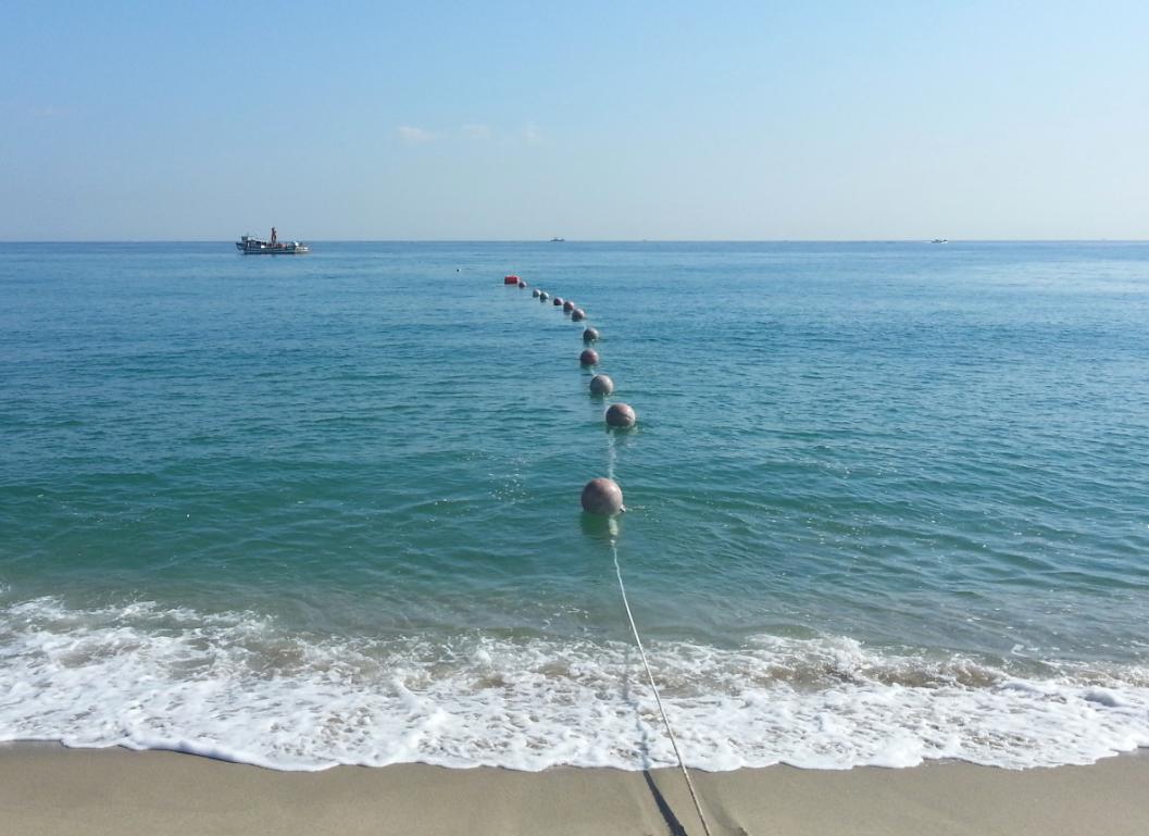
Fig. 3. A ship laying submarine sonar cable.
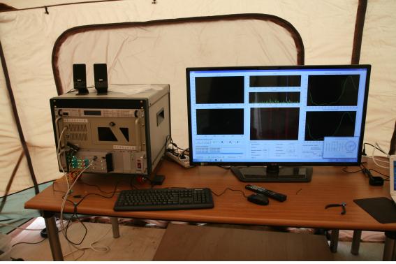
Fig. 4. Equipment for analysis of data transmitted in realtime via submarine sonar cables, with a monitor displaying sonar signals.
- Content Manager :
- Last Update : 2024-01-31